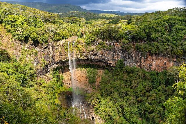
Black River Gorges National Park
Mauritius's largest national park: 6,574 hectares of primary forest, 60 km of marked trails and the last refuges of the pink pigeon and kestrel. The 10 km Macchabée trail from Pétrin to the visitor centre is a classic.
Tip: Two entrances: Pétrin (plateau) and the visitor centre on the Black River side. Hiking shoes and water essential, patchy mobile signal.
360° view
Drag to look around. Google Maps imagery, loaded only if you click.
Mauritius's great wild space
Proclaimed on 15 June 1994, the park protects 6,574 hectares of forest in the south-west, according to the National Parks and Conservation Service that runs it. It includes the island's highest point, Piton de la Petite Rivière Noire (828 m), and the largest surviving stands of native forest.
This is the stronghold of the pink pigeon, the Mauritius kestrel and the echo parakeet, three birds pulled back from the brink of extinction. Fruit bats, macaques and endemic green day geckos are common sightings too.
Two entrances, two moods
On the east side, Pétrin sits on the plateau at around 650 m, a few minutes from Grand Bassin, and is the trailhead for upland forest and ridge walks. On the west side, the Black River Visitor Centre lies at the foot of the gorges near Grande Rivière Noire, about 30 minutes from Flic en Flac. From Port Louis allow roughly an hour to either entrance, 1h15 to 1h30 from Grand Baie.
Entry is free (checked in October 2026). Both centres hand out maps and advice and you can log your route there. Opening hours differ between sources and seasons, so check with the NPCS before you go and be out well before dark.
Which trail to pick
Some 60 km of trails are marked. Easy: Savanne Trail (6 km return). Moderate: Macchabée Forest Loop (14 km return), Mare Longue Loop (12 km), Black River Peak Trail (9 km return) and Paille en Queue Trail (3 km).
Strenuous: the Macchabée Trail (10 km), dropping from Pétrin at about 650 m to the Black River Visitor Centre at about 100 m, plus the Parakeet Trail (8 km) and Cascade des Galets (3 km return). The Macchabée traverse is one way, so book a taxi pick-up at the bottom.
Season, weather and kit
Rainfall ranges from 1,000 mm a year in the drier parts to 4,000 mm on the uplands. May to October is the most comfortable hiking season; in summer (December to March) showers turn slopes into mud. Mist often rolls over the plateau in the early afternoon, so start early.
Wear proper hiking shoes with grip, carry 2 litres of water each, a windproof layer and an offline map: there is no mobile signal in the gorges. Pets, fires and smoking are banned, and camping needs a permit.
Combine with
Non-hikers can see the park from the Plaine Champagne road, stopping at the Black River Gorges Viewpoint and Alexandra Falls. Grand Bassin is next door to Pétrin, while Chamarel and its Seven Coloured Earth round off a day on the west side.
Frequently asked questions
Is Black River Gorges National Park free?
Yes, entry to the park and its trails is free. You only pay if you hire a private guide or book an organised hike.
What is the best hike in Black River Gorges?
For a first visit, the Macchabée Forest Loop from Pétrin (14 km return, moderate) delivers native forest and a big viewpoint. Fit walkers do the 10 km Macchabée traverse down to the Black River Visitor Centre.
Do I need a guide in Black River Gorges?
Not for the main marked trails. A guide is worth it for Black River Peak in poor weather or for tougher routes such as Cascade des Galets.
When is the best time to hike?
May to October, when it is cooler and drier. Go in the morning, as mist and showers often arrive on the plateau in the afternoon.